Characteristics of geomorphological terrain analysis
Geomophological terrain analysis is based on the demarcation of individual landforms, and the assessment of its formation and approximate age. Circumscribed lanforms are subsequently divided into groups specified by the origin of their formation:: i) struktural and tectonic shapes, ii) denudation, iii) accumulative shapes, iv) anthorogenic shapes. The analysis is based primarily of the interpretaion of a digital landform model. If necessary, it can be supplemented with terrain documentation or the evaluation of satellite and aerial shots.
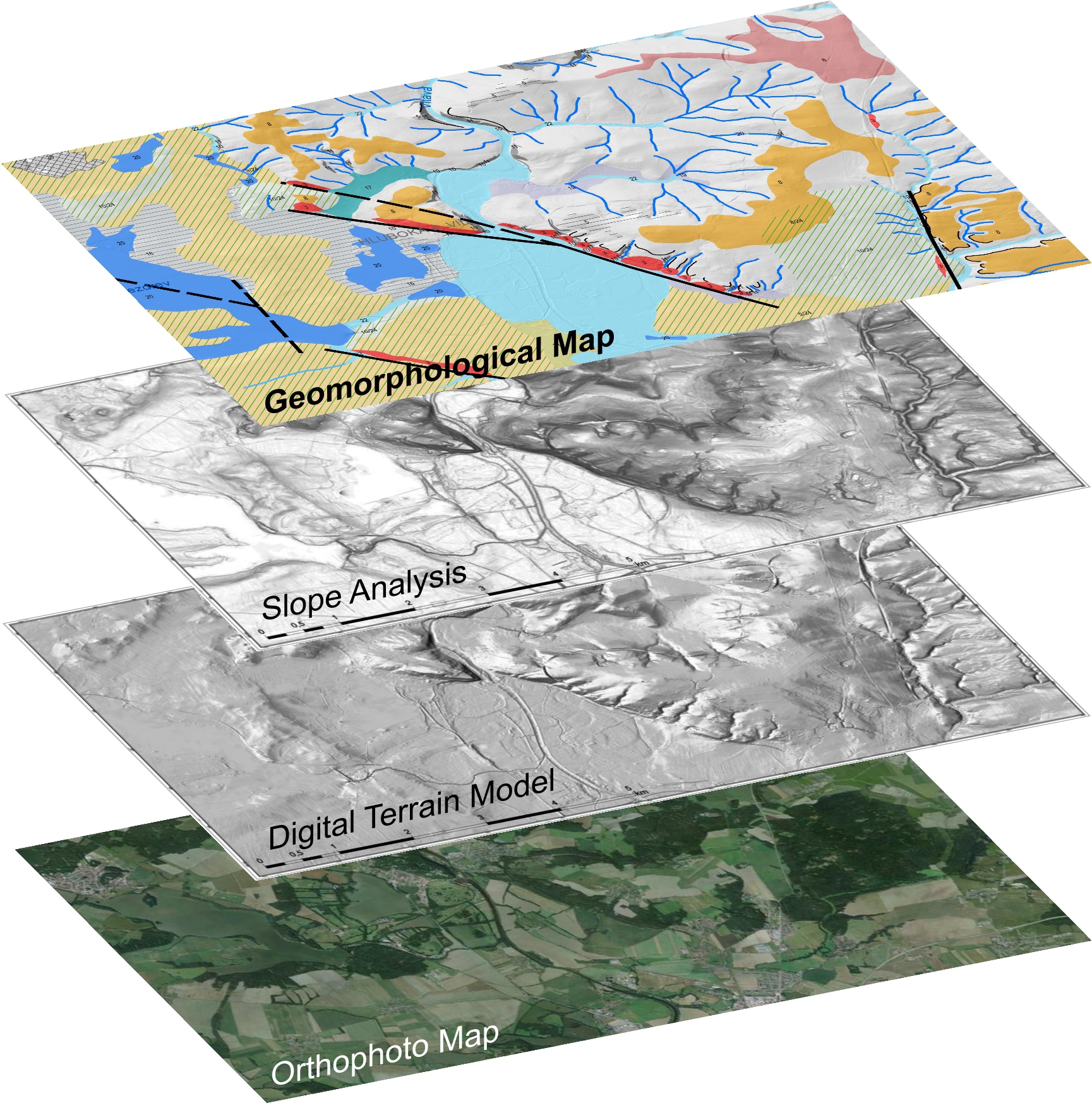
Geomorphological landform analysis output
The output of the analysis is a geomorphological map that represents a generalized image of the examined landform development. Individual landform shapes are labeled on an appropriate map base (with basic topographic figures) in a form of polygons, lines and eventual marking points. The scale of the map affects the extent of detail. Individual shapes are divided on the basis of their date of formation. The map is supplented with a textual output.
Practical use of the geomorphological landform analysis
The results of the geomorphological landform analysis serve as a basic data set needed for analyzing the vulnerability of the territory regarding natural processes such as floods, erosion landslides, earthquakes, etc..
The knowledge of geomorphological terrain is the basis for spatial planning, liear construction planning (highways, railways), water reservoir construction planning and preparatory workd for both surgace and underground dumping grounds (ex. Tailing ponds, nuclear waste storage).
Contacts: Divize Gemec Žacléř